Today is the last day of 2013. Here are 13 pictures to celebrate 2013. All of these photos were taken during 2013 and all but one appeared in one or more posts on this blog.
January - This photo of a Bohemian Waxwing appeared a post from January 22nd.
February - This photo did not appear in any posts on this blog. I took very few photographs in February. I like this one because of the circular pattern formed in the ice where the Chippewa River turns around a bend.
March - This photograph of a Pileated Woodpecker appeared in a post on March 7th.
April - April is usually one of my favorite months to take photographs. However, cold weather pushed the Spring wildflowers back into May and I took very few photos in April. This photo of a Common Eastern Garter Snake was featured in a post on April 23rd.
May - This photo of a male Tree Swallow appeared in a post on May 16th.
June - I took lots of photos in June so it was difficult to pick a favorite. This photo of a Green Frog and a Ground Pine was taken while sampling aquatic macroinvetebrates at Hall's Lake with the Chippewa Watershed Conservancy. The post on this event was published on June 28th.
July - In July, my wife and I went on vacation to Maine for nearly two weeks so I didn't publish very many posts. One of my favorite photos (from Michigan) from July was this image of a Northern Water Snake taken in the Chippewa River in Mt. Pleasant. This image was posted on July 25th.
August - My favorite photo from August is this one of two axes that I published in a post on logging tools from August 7th. I didn't take a large number of photos in August and I really like the lines and the colors in this image.
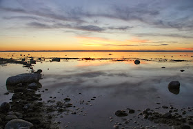
September - This photo of a sunset might be my favorite picture of 2013. It was taken at Old Mission Point in Grand Traverse County and published on September 30th.
October - This fall photo of light streaming through the trees is one of the few photos that I took in the town I actually live in (Alma). This photograph was taken in Pine River Park and published in a post on October 8th.
November - In November, Shara and I went back to Traverse City for Veterans Day weekend. There were no crowds like there are during the Summer and early Fall and the scenery was just as beautiful as always. This photo is of the clouds, water, and beach at Glen Haven was posted on November 13th. This was one of my favorite trips of the year for photography.
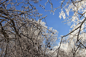
December - This image of the Pine River in Alma was taken less than five blocks from my house. It appeared in a post on December 24th.
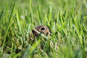
Bonus Photo - I said I was going to post 13 of my favorite photos from 2013. Because there are only 12 months in the year, I had to pick to photos from one month. June was probably my favorite month of 2013 for photos so here is another from June. This picture of a Thirteen-lined Ground Squirrel was taken on the lawn outside our office door on June 13th.
Tuesday, December 31, 2013
Monday, December 30, 2013
Ice Storm Photos
On the night of 21-22 December much of Lower Michigan experienced an ice storm. This storm knocked out power for nearly half a million homes in Michigan before continuing on through Canada and Maine. Some people are still without power more than a week later. Fortunately, Alma did not have any major damage from the storm. We ended up with about 1/4 inch of ice covering everything. It made for a beautiful, but slippery, scene in our neighborhood.
Friday, December 27, 2013
Native Species Profile - Yellow Water Lily
This post is part of a continuing series on plants found in one of the most common habitat types in Mid-Michigan - the Emergent Marsh. Profiles of other plants found in this habitat include: Great Blue Lobelia, Blue Flag Iris, Blue Vervain, Common Arrowhead, Common and Narrow-leaf Cattails, Lizard's Tail, Marsh Marigold, Spotted Joe-Pye Weed, White Turtlehead, and Giant Bur Reed.
All of the plants listed above are emergent plants that rise above the surface. Other emergent plants have leaves that float on the surface of the water. One common plant with floating leaves is the Yellow Water Lily (Nuphar variegatum). Also known as Yellow Pond Lily or Spatterdock, Yellow Water Lily is found throughout the northern half of North America - in 24 states ranging from Idaho eastward to New England, as far south as Kansas and Maryland, and in all Canadian provinces and territories.
Yellow Water Lily is found growing in shallow water (less than 7 feet deep) in emergent marshes, ponds, lakes, bays, streams and bogs. The plant's leaves are roughly arrowhead or heart-shaped, grow up to 10 inches long, and are usually found floating on the water's surface.
The plant's flowers usually rise above the water's surface on individual stalks. Flowers are small, yellow, and globe-shaped. Individual flowers may be between 1 to 2 inches across. Each flower has only three petals. The Yellow Water Lily blooms between July and August.
Basic Information
Yellow Water Lily
Nuphar variegatum
Height: aquatic, floating leaves
Habitat: shallow water, ponds, lakes, bays, bogs,
streams
Flower
Color: yellow
Bloom
Time: July – August
All of the plants listed above are emergent plants that rise above the surface. Other emergent plants have leaves that float on the surface of the water. One common plant with floating leaves is the Yellow Water Lily (Nuphar variegatum). Also known as Yellow Pond Lily or Spatterdock, Yellow Water Lily is found throughout the northern half of North America - in 24 states ranging from Idaho eastward to New England, as far south as Kansas and Maryland, and in all Canadian provinces and territories.
Yellow Water Lily is found growing in shallow water (less than 7 feet deep) in emergent marshes, ponds, lakes, bays, streams and bogs. The plant's leaves are roughly arrowhead or heart-shaped, grow up to 10 inches long, and are usually found floating on the water's surface.
The plant's flowers usually rise above the water's surface on individual stalks. Flowers are small, yellow, and globe-shaped. Individual flowers may be between 1 to 2 inches across. Each flower has only three petals. The Yellow Water Lily blooms between July and August.
Basic Information
Yellow Water Lily
Nuphar variegatum
Wednesday, December 25, 2013
Tuesday, December 24, 2013
The morning after a snowstorm - 24 December 2013
Last night it snowed several inches of very light fluffy snow. With no wind, that snow was all still clinging to the trees when I awoke this morning, and amazingly the sun was coming out from behind clouds! Since December 6th it has been cloudy almost constantly, it has snowed or rained every day but one within that time span and the temperature has risen above freezing only twice. Today it is forecast to be partly cloudy with a high temperature of 16 degrees Fahrenheit. Because it was so calm and beautiful this morning, I decided to go down the street to a local park here in Alma to take a few pictures.
 |
| Ice and snow on an ornamental tree |
 |
| Looking downstream on the Pine River from a pedestrian bridge - Riverwalk Trail in Alma, MI |
 |
| A hen Mallard on the Pine River |
 |
| Upstream from the pedestrian bridge - Riverwalk Trail in Alma, MI |
 |
| Another view downstream showing the changing light |
 |
| Snowy field and fencerow |
 |
| Mallard ducks on the ice shelf - Pine River in Alma, MI |
 |
| One more view downstream - the light conditions continued to change |
 |
| Mallard hen on the Pine River - Alma, MI |
Monday, December 23, 2013
Feed the Birds - Plant a Garden
Winter is the time of year when people think most about feeding the birds. Rather than just hanging up a bird feeder and providing sunflower seeds and cracked corn, why not do something that will feed the birds year round? With just a little bit of effort you can plant a native plant garden that will provide seeds and fruit to feed your feathered friends year round. Because these are all naive plants, they will also attract a wide variety of insects to your garden which provide further food for the birds. As an added benefit, once you have planted these trees, shrubs, and wildflowers you can enjoy their beauty year round too.
What should you plant in your garden for the birds?
Saturday, December 21, 2013
Winter Solstice
It has felt like Winter for several weeks, but Winter officially begins today at 12:11PM EST.
The moment this change of seasons occurs is known as the Winter Solstice. The word Solstice comes from the Latin words sol (sun) and sistere (to stand still). Today the sun will have reached its lowest position in the southern Sky, giving us our shortest day of the year. On the Summer Solstice, Mid-Michigan received approximately 15 hours and 24 minutes of sunlight. Today Mid-Michigan will see only 8 hours and 58 minutes of sunlight, but from now until the Summer Solstice each day will grow longer.
The Earth rotates around its axis approximately once every 24 hours. However this axis is tilted at 23.5 degrees from the vertical. The points on the globe that the axis revolves around are referred to as the North and South Poles. The axis is always pointed toward the same location in the sky. The North Pole points toward the "North Star" - Polaris.
As the earth revolves around the sun, sometimes the North Pole is closer to the sun, sometimes the South Pole is closer to the sun. When the North Pole is at its closest, we experience Summer in Mid-Michigan and the Southern Hemisphere experiences Winter. When the North Pole is at its furthest, we experience Winter and the Southern Hemisphere experiences Summer.
If you were to arise at dawn every day of the year and record at which point on the horizon the sun rises from you would be able to track the progression from the Summer solstice (in which the sun rises furthest North) to the Winter Solstice (in which the sun rises furthest South) and back again. Tracking the postion of the rising sun was one of the earliest astronomical observations. Many ancient monuments were constructed to act as solar observatories, recording the longest and shortest days of the year.
In honor of the Solstice...
 |
| A low winter sun - Chipp-A-Waters Park, Mt. Pleasant, MI |
Thursday, December 19, 2013
Morning Sky - 19 December 2013
Wednesday, December 18, 2013
Native Species Profile - White Camas
One of my favorite habitats is the Great Lakes coastal dune complex. Dunes are often considered among the most threatened habitat types here in the Great Lakes - they can only exist in certain places along the lakes and are often under threat of development. Because the dunes are threatened, many of the plants that live there are also threatened. Some of these plants are endemic to the Great Lakes dunes (meaning that they are found nowhere else in the world) like Pitcher's Thistle. If their habitat is not preserved, they will go extinct.
Fortunately, other plants that are found in the dune complex can also be found elsewhere so their future is probably more secure.
One such plant is the White Camas (Zigadenus glaucus).
Fortunately, other plants that are found in the dune complex can also be found elsewhere so their future is probably more secure.
One such plant is the White Camas (Zigadenus glaucus).
 |
| White Camas (Zigadenus elegans) |
Monday, December 16, 2013
The Face of the Moon (15 December 2013)
December's full moon is not until tomorrow (17 DEC 2013). According to data from the United States Naval Observatory, 96% of the moon's visible surface was illuminated last night. Although this is not a particularly sharp image, many of the moon's recognizable features are visible.
If we divide the moon in half from top to bottom, the left half of the moon is dominated by dark "seas" or maria (from the Latin mare for "sea"). These "seas" are actually flat plains made of dark basalt, a volcanic rock. The Mare Tranquillitatus or "Sea of Tranquility" was the site of the Apollo 11 moon landing.
The white areas that surround the maria are called the lunar highlands or terrae (from the Latin terra for "land"). The highlands are formed of older rock than the maria pitted with impact craters. Some of these craters can be seen in the photograph below - especially three craters on the dark maria. These three craters appear as bright spots on the otherwise dark basaltic surface.
 |
| Moon at 96% visibility |
If we divide the moon in half from top to bottom, the left half of the moon is dominated by dark "seas" or maria (from the Latin mare for "sea"). These "seas" are actually flat plains made of dark basalt, a volcanic rock. The Mare Tranquillitatus or "Sea of Tranquility" was the site of the Apollo 11 moon landing.
 |
| Maria of the Moon |
The white areas that surround the maria are called the lunar highlands or terrae (from the Latin terra for "land"). The highlands are formed of older rock than the maria pitted with impact craters. Some of these craters can be seen in the photograph below - especially three craters on the dark maria. These three craters appear as bright spots on the otherwise dark basaltic surface.
 |
| Three lunar impact craters |
Friday, December 13, 2013
The Human Landscape - Old Barns
Sometimes we forget that humans are part of nature. Not all that mankind does to the environment is harmful. Many of our landscapes have been touch by human hands for so long that we cannot imagine how they would look without the human touch.
One of my favorite parts of the human landscape is old farms and especially old barns.
One of my favorite parts of the human landscape is old farms and especially old barns.
 |
| Brunson Barn - Port Oneida Rural Historical District, Sleeping Bear Dunes National Lakeshore |
 |
| Brunson Barn - Port Oneida Rural Historical District, Sleeping Bear Dunes National Lakeshore |
 |
| Grainery - Forest Hill Natural Area, Alma, MI |
 |
| Barn - Forest Hill Natural Area, Alma, MI |
 |
| Barn Detail - Forest Hill Natural Area, Alma, MI |
 |
| Treat Barn - Sleeping Bear Dunes National Lakeshore |
 |
| Tweddle Barn - Sleeping Bear Dunes National Lakeshore |
 |
| Brunson Barn - Port Oneida Rural Historical District, Sleeping Bear Dunes National Lakeshore |
 |
| Brunson Barn - Port Oneida Rural Historical District, Sleeping Bear Dunes National Lakeshore |
 |
| Barratt Pig Barn - Port Oneida Rural Historical District, Sleeping Bear Dunes National Lakeshore |
 |
| Carsten Burfiend Farm - Port Oneida Rural Historical District, Sleeping Bear Dunes National Lakeshore |
 |
| Farm Buildings - Rosebush, MI |
 |
| Old barn across the road from Forest Hill Nature Area - Alma, MI |


