Friday, October 30, 2015

The Sun Comes Up...

Sunrise near Mt. Pleasant (30 OCT 2015)

Just a photo of this morning's sunrise. 

The best sunrises always come in the fall and winter months.  The right kind of clouds are needed for a good sunrise - dark and brooding, with the hint of snow.  The clouds of spring and summer rarely get it right. 

The best sunrises take their time.  The fall and winter sun seems to want to stay just over the horizon and it comes creeping slowly into view, like a shy cat.  The sun of spring and summer seems to leap up over the horizon and come bounding toward you like an exuberant dog. 

Summer sunrises tend to be quickly forgotten. The length of the day makes us feel that the sun is our right - that it will always be there.  In fall and winter, we know that the sun is a privilege.  We only get its joy for a few hours a day if we are lucky.  Even at 20 below zero, a winter sunrise leaves you feeling warm.  It is not taken for granted. 

Thursday, October 29, 2015

Event Reminder - 2015 Mid-Michigan Rock Club Annual Show


Just a reminder that the Mid-Michigan Rock Club is hosting its annual show and sale this weekend at the Great Hall Banquet and Convention Center in Midland.  The Great Hall is located at 5121 Bay City Road on the east side of Midland, just off of US-10.

The show is open 10:00AM to 6:00PM on Saturday (31 OCT) and 10:00AM to 4:00PM on Sunday (01 OCT).  Admission to the show is $1.00 for adults, $0.50 for youth ages 12 to 17, and free for children under 11 (w/ and adult).  Scouts and military members in uniform are also admitted for free. 

If you are a rock hound or an aspiring rock hound be sure to attend.  This is a great way to add to your collection.  The Mid-Michigan Rock Club always has a selection of low-priced rock and mineral samples that can be used to build a beginner's rock collection - we made collections for nieces and nephews last year for Christmas!

Wednesday, October 28, 2015

Teaching about "Place"

*This is a post that I have been trying to write for quite some time and I'm still not sure if it says what I want, but here goes nothing.*

When people ask me what I do for a living, I usually tell them that I run an environmental education program.

This is true, but it is only part of the story.

My job is really about "place".

I teach children and adults about the place that I call home - Mid-Michigan.  Teaching about the environment is wonderful and necessary, but I believe it can't be just about the abstract concept of "the environment".

When I teach about forests, I want to talk about the forests that people can see a short walk or drive from home.  Why would I talk about the forests of the Pacific Northwest or the Amazon rain forest when there are real forests nearby?


When I talk about wetlands, instead of talking about the Everglades or the Mississippi Delta, I talk about the marshes, swamps and vernal ponds found close to home. 


When things work out, I get to take students to woods and wetlands and let them use their senses - touch, hear, see, smell, and (occasionally) taste.


I want students to know and understand the habitats and natural inhabitants that make Michigan  unique, that give it a sense of place.

I want the students and the adults that I teach to not only know which species live here, but also how and why those species survive.  I want them to wonder "How does a butterfly live through Michigan winters as an adult?"


I want them to wonder what is happening underneath all of the snow.  And to want to know so badly that they will go dig it up to find out.


When I teach about adaptations, I want to use real world examples that everyone can relate to such as the color difference between male and female Red-winged Blackbirds.  Many students (and adults) don't even realize that these two birds are the same species.  I want kids to be able to go home and explain to their parents why the male and female birds look so different from each other.


Sometimes I act silly when I teach - acting out the way a Great Blue Heron stalks through water...


or the way a White-tailed Deer bobs its head when it is trying to figure out whether something is dangerous..


At other times I am completely serious; such as when I talk about the potential dangers of eating things found in the woods.  I don't want to scare students, but I do want them to be mindful. To know that there are things in the woods that can harm you gives a bigger thrill to exploring.


I want people to meet their local plants and animals.  It's easy to say "I care about the environment";  it's better to recognize and name the plants and animals that are my neighbors.  These are the things that make a place unique.  If I know my wild neighbors I am more likely to respect them and want to protect them.  This is why I use photographs that I have taken whenever possible in presentations.


When I teach about place, I am summing up everything that makes Mid-Michigan unique and special.  

This place called Michigan is surrounded by the four of the five Great Lakes.  The lakes moderate our climate and give us an abundance of fresh water that is unheard of in the rest of the world.  Their impact is huge.  They make Michigan the place that it is.


The lakes were carved out by glaciers during the last ice age.  Beyond the lakes, the glaciers impact our topography in other ways.  In some places they carved out deep valleys or scoured rock bare,


but most of the state is covered by sand, rock, and gravel.  These sediments were picked up by the glaciers in Canada, ground down, and finally deposited in a thick layer over Michigan.  When you dig a hole in Michigan, you are digging down through time.  The sediments tell a story of the past.  When I did a hole I am looking back ten thousand years to what the glacier has left behind, and even further back into time.

 
When I visit the shores of the Great Lakes I see rocks that formed hundreds of millions of years ago when Michigan was covered by a shallow tropical sea.  This legacy is reflected in our state stone - the Petoskey stone.  I can talk about this rich geologic history when I teach students about rocks and minerals.


The lakes and the soils left behind by glaciers allowed Michigan to grow one of the richest forest habitats in eastern North America.  Lumber was harvested across the state for nearly a hundred years to build not only the cities and towns of Michigan, but also the cities of the rest of the nation.

 
To know a place requires you to know all of these things.  Place is not just location.  It is the past and the present.  It is the sum of the physical and human characteristics of a location.  Physical and cultural geography, geology, history, economics, and biology combine to describe place.
 
The desire to know a place requires you to ask questions.  Why do some animals call this place home and not others?  What conditions allow this plant to grow in some locations and not others? What are those insects that live in that pond?


I hope that after an outdoor or classroom presentation, the students will leave with these questions in their mind.  Hopefully they will pursue those questions and find an answer.  If they do, they will have a greater knowledge of "place" and I will have done my job.  I'm keeping my fingers crossed and my curious mind open.

Monday, October 26, 2015

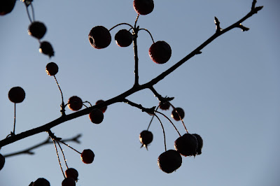
Fall Crabapples Photos

A heavy frost covered everything in the Mt. Pleasant area this morning.  It began to melt quickly once the sun came up, leaving water droplets on everything it had touched including this crabapple tree.


Friday, October 23, 2015

Potential (a haiku)


                                                              Like tiny fireworks,
                                                              Butterflyweed seeds explode
                                                              as future flowers.

Wednesday, October 21, 2015

Third Grade Dendrochronology Studies

I spent much of the past month teaching third grade students about trees.  One of the activities that we do is called dendrochronology.  Dendrochronology is the study of the annual growth rings in tree trunks or limbs.  The word comes from the Greek words dendron (tree limb), khronos (time), and logia (study). 

Dendrochronology is more than just determining the age of a tree by counting its rings. It is also a useful tool for the study of long term climate because the width of growth rings varies with the amount of rainfall that the tree receives.  A narrow ring can indicate low rainfall during a growing season while a nearby wide ring indicates abundant rain during that growing season.

Each ring consists of a band of light colored "spring wood" and a dark colored band of "summer wood".  As its name implies, spring wood forms early in the growing season.  It consists of large  cells with thin cell walls.  As the growing season winds down during the summer months, these cells become smaller and the cell walls become thicker, giving the summer wood a darker appearance than the spring wood.  At the end of the growing season cell growth stops completely and the tree remains dormant until the following growing season.  This transition is from one growing season to another is usually easy to see when examining the rings.


Because I normally do this activity with third grade students we don't get to involved in interpreting the rings beyond finding the age of the tree.


Different tree species naturally grow at different rates so the rings in some samples are easier to see than they are in other samples.  Here are sections of trunk from three different species.  These samples have been sanded smooth to make it easier to see the rings.  I scanned the sections of trunk to create these images.

The first sample is a section of Green Ash (Fraxinus pennsylvanica).  It measures approximately 5 inches (13 centimeters) across at its widest point.  The dark mark just above and left of the center of the trunk is an old branch scar.  The branch stopped growing, fell off, and was eventually hidden by new growth.  Green Ash is a wetland species and typically experiences fast growth, making the rings east to see and count.  The lopsided growth of the trunk may be a result of the old branch scar, less exposure to sunlight on that side of the tree, or competition from other trees on that side.


The second sample is from a Red Pine (Pinus resinosa).  This sample is approximately 9 inches (24 centimeters) across at its widest and 7.75 inches (19.5 centimeters) across at its narrowest dimension.  This tree was one of many planted in rows.  The oval growth may have resulted from there being no competition  on those sides of the trunk.  I would be curious to see if other trees in this grove display similar growth patterns.  Red Pine is typically an upland species.  The growth rings on this sample are fairly evenly spaced and easy to see.  There is a branch scar at about the 1:00 position from center halfway to the edge of the trunk.  This scar did cause uneven growth for several year, but the growth eventually evened out.

The third sample is a section of an American Beech (Fagus grandifolia).  American Beech is considered an upland species.  It is long-lived and usually experiences slow, even growth,  This sample measures approximately 8 inches (20 centimeters across).  Although this section of branch is almost round, it did not experience even growth.  The rings in the upper right quarter are narrower and the wood is more dense.  I believe that this was probably the underside of the branch - the weight of the branch would have caused this wood to compress more when it was growing than the upper side of the branch, making the rings narrower.  This sample is much older than the Green Ash and Red Pine trunks - it has over 100 annual growth rings!


For more information, including microscopic views, check out this post from November 2013.

Tuesday, October 20, 2015

Forest Ecology Studies at Audubon Woods (16 OCT 2015)

Big-tooth Aspen leaf (October 2015)
 
Last Friday (16 October) I met with 3rd, 4th, and 5th grade students from Winn Elementary at the Chippewa Watershed Conservancy's Florence Maxwell Audubon Woods Preserve to continue an ongoing forest ecology study.  Students now come to the preserve twice a year (fall and spring) and perform a series of activities.  In the past, students have recorded sightings of plants and animals, collected leaves for preservation, and measured the Diameter - Breast Height (DBH) of trees.  In 2014 students counted the number of trees growing in 1/10 acre plots within the forest and used these numbers to estimate the total number of trees (with a diameter of greater than 1 inch) growing in the 40 acre preserve - their estimate between 24,000 and 29,000 trees!

Sassafras seedling at Audubon Woods Preserve


Counting Leaves

In June of 2015, the students were asked to calculate the number of leaves found on the forest floor.  They accomplished this by counting the leaves in 1 sq. ft. plots and using that data to estimate the number of leaves in one acre (43,560 sq. ft.), then multiplying that number by 40 to estimate the number of leaves on the entire forest floor.  Their estimates concluded that there were between 311,926,814 (low estimate) and 431,725,571 (high estimate) total leaves on the forest floor.

Winn Elementary students counting leaves in a square foot plot at Audubon Woods Preserve (October 2015)


Removing every single leaf from a plot


Last week the students repeated this experiment.  This time each group of students was asked to count three different one foot squares.  Here is the results from one of the three classes.


This class estimated that there were 248,519,148 leaves on the forest floor.  This number is significantly lower than the number from even the lowest estimate from June.  Many of the leaves that were present in June have since broken down and decomposed through the actions of invertebrates, fungi, and bacteria.

Fungi at Audubon Woods


Weighing Leaves
After determining the number of leaves on the forest floor, the next logical step was to try to determine the mass of all of those fallen leaves.  To perform this task, students collected 100 random leaves from the forest floor in a zip lock bag and then weighed them using a digital scale.  They then subtracted the weight of the bag and divided the result by 100 to determine the average mass of each leaf.  Measurements ranged from a low of 0.5888 grams/leaf to a high of 0.8888 grams per leaf.  These numbers were multiplied by the average estimate  of the number of leaves in the forest.  The resulting answer was then converted from grams to kilograms by dividing by 1,000.  Here are the results from one class.

Weighing leaves - Audubon Woods (October 2015)
 

They estimated that the total mass of the leaves on the forest floor was between 146,328.074 kilograms and 220,883.818 kilograms!  Converted to pounds, the leaves weigh between 322,598.18 and 486, 965.46 pounds!

Other Activities

Measuring canopy cover with a 10 x 10 grid

In addition to estimating both the number and weight of the leaves on the forest floor, students also examined canopy cover and measured the size of Sugar Maple leaves.   To measure canopy cover, one student lay on the ground and looked up at the sky through a 10 x 10 grid while another student recorded the grid squares that were covered by leaves.  They then had to answer the following questions:

       Do you think the amount of canopy cover will affect the types of wildflowers and other small
       plants that can grow in the forest?  Why or why not?

       Do you think the canopy cover can affect the amount of moisture in the soil?  Why or why not?

This job requires teamwork


Students measured the length and width of Sugar Maple leaves to determine an average leaf size.  After calculating an average size they had to explain why they think some leaves are larger than others.


Measuring Sugar Maple leaves

For some of the students this was their first trip to Audubon Woods.  For the 5th graders this was their fourth visit and they have been able to notice changes to the woods over the past two and a half years.  We already have a visit scheduled for late spring 2016.  Stay tuned for updates.

Monday, October 19, 2015

Fall colors at Sylvan Solace Preserve


On Saturday (17 OCT) I led a walk for the Chippewa Watershed Conservancy at their Sylvan Solace Preserve west of Mt. Pleasant.  I only had one couple show for the scheduled walk, but we had a great time discussing the why and how of fall color change.  We marveled over how the trees can tell us the history of the landscape.  We walked and talked for about an hour along the preserve's River Loop Trail enjoying the crisp fall air and the brilliant colors of the leaves.

http://i0.wp.com/www.chippewawatershedconservancy.org/wp-content/uploads/2014/08/Sylvan-Aerial-2009.gif

When our scheduled walk was over, I went back out on the trail to photograph a few of the trees and other fall scenery.  Here is a little bit of what you missed.

Fungi on rotting log

Big-tooth Aspen against the sky

Red Maple leaves

Maple-leaf Viburnum

Fungi on an aspen log

Oak and Aspen along the River Loop Trail

Aspen trunks

Woolly Oak Galls and spider - the gall are caused by small wasps

White Oak leaves