Showing posts with label scat. Show all posts

Tuesday, February 12, 2019

Tracks, scat, slides, and porcupine butts

It seems like the weather has kept me cooped up indoors all winter.  Over the past two weeks, local schools have been in session for a grand total of two days out of ten; on one of the days that they actually had school there was a weather delay.  I have already had to cancel or reschedule thirty-five school programs since the second week of January.  So imagine my excitement to have nice weather on Saturday (09 February) for a planned animal signs hike at the Chippewa Watershed Conservancy's Hall's Lake Natural Area.  Sunny weather and a couple of inches of fresh snow!  What more could we ask for!


Hall's Lake is located on the far west side of Isabella County.  The three main preserves (Kabana, Neely, and Schaftenaar) that make up Hall's Lake Natural Area encompass 155 acres of woodland and wetland protect nearly one half of the shoreline of Hall's Lake from development.  This land serves as habitat for a wide variety of animal species.  I was fairly confident that we could find tracks (or other sign) for several common species such as white-tailed deer, coyote, squirrels, mice, and voles.  All of these tracks were present and easy to find.  We also discovered a set of tracks belonging to either a small American mink or a large long-tailed weasel - there is a little bit of overlap in track size so I was not 100% confident in assigning the tracks to one species.

The best tracks of the day were a surprise to me - they probably shouldn't be, but I rarely see them.  We found tracks from both the North American river otter (Lontra canadensis) and bobcat (Lynx rufus) along the shore of Hall's Lake.  At first I had some difficulty identifying the tracks because both animals had traveled along the same path and their prints sometimes overlapped.  Also, snow had drifted into many of the tracks making it hard to see their features.  Finally, the tracks diverged in a sheltered area and I was able to see enough identifying features to make a positive identification.

This is a print from an otter - the important thing to note is that it has five widely spread toes.


Here is a set of all four otter feet as it bounded along in the snow - the otter was traveling from right to left in the picture.  We did notice several tail drags along this path, but I didn't photograph any of them.


Here is one of the bobcat tracks.  Note how this track has only four toes.  We also found several coyote tracks.  It's easy to tell the bobcat and coyote tracks apart; look for toenails.  If you see toenails the print belongs to a coyote - cats (such as bobcats) usually have their claws retracted and the nails rarely show up in their footprints.


In this picture you can easily see the spacing of the bobcat's tracks.  At one point I couldn't decide if some of the tracks belonged to a small bobcat or a large domestic cat.  The prints were in rough terrain and the stride was quite short, but here in the open on this trail the animal opened ups its gait.


We eventually discovered the tracks of not one, but two bobcats on site.  The two could be told apart  by the different size of their tracks.  Like most wild cat species, bobcats will not usually share a territory with another animal of the same sex.  Males normally have larger territories than females.  Either Hall's Lake Natural Area is on the boundary of two territories of same-sex animals or two animals of the opposite sex have territories that overlap.

Bobcats often mark their territory by urinating or defecating in places where other Bobcats (and other predators such as coyote or red fox) will notice it.  Just like a domestic cat, this Bobcat kicked up the snow after leaving its mark.  Fox and coyote (and my dog) exhibit the same kind of behavior.


The bobcat scent station was only the second coolest thing we found during the hike.  My favorite can be seen in the two pictures below - an otter slide!  With short legs and a body shaped like a sausage, sometimes the easiest way for an otter to move (especially downhill) is to slide on its belly.

Checking out the otter slide

Slide!
There was one more stop we had to make.  Hall's Lake Natural Area has a well-known porcupine den tree.  In all the times I've ever been to Hall's Lake, I've never seen more of the porcupine than its rear end hanging out of a hole in the tree.  Last year during a hike at Hall's lake we found a second porcupine high up in an Eastern White Pine, but no such luck today.  So on to the den tree...


Normally, when I see the porcupine it's tucked up in the top of that hole.

Believe it or not, this is actually the best view that I have ever had of this porcupine.  This individual porcupine seems to be almost completely nocturnal.  It comes out of this den tree at night and travels to a nearby stand of pine trees where it feed before returning to the den to sleep away the day.


All in all, I'd declare this a very successful animal sign hike, filled with tracks, scat, slides, and porcupine butts! 

Thursday, January 17, 2019

Trail cam pics and a walk in the January woods.

In late December I placed my trail cameras in the woods for the first time in nearly a year.  Today I went to switch out the memory cards.  Although I managed to get pictures of red fox, raccoon, squirrels, and deer (including several bucks) I was disappointed by the results and ended up moving both cameras.

A fox runs in front of the camera

Part of a herd of deer, including two bucks, passing by the camera

After moving the cameras I used the opportunity to take a walk through the woods and take some photographs.  There was no snow on the ground, but lots of ice.  My favorite photos of the day were probably those showing leaves locked in ice.  Here are a few of the images that I captured.

Bright sunlight has been a rare sight in recent days

This picture was not planned - the plane flew over just as I was taking the picture.

Flowing water carved this channel down through the ice

Many shades of brown

Living and dead trees stand bare in the winter swamp


Oak leaves trapped in ice

Coyote scat on top of a pile of deer scat

Water levels have dropped several inches since this ice formed

Eastern Hemlock


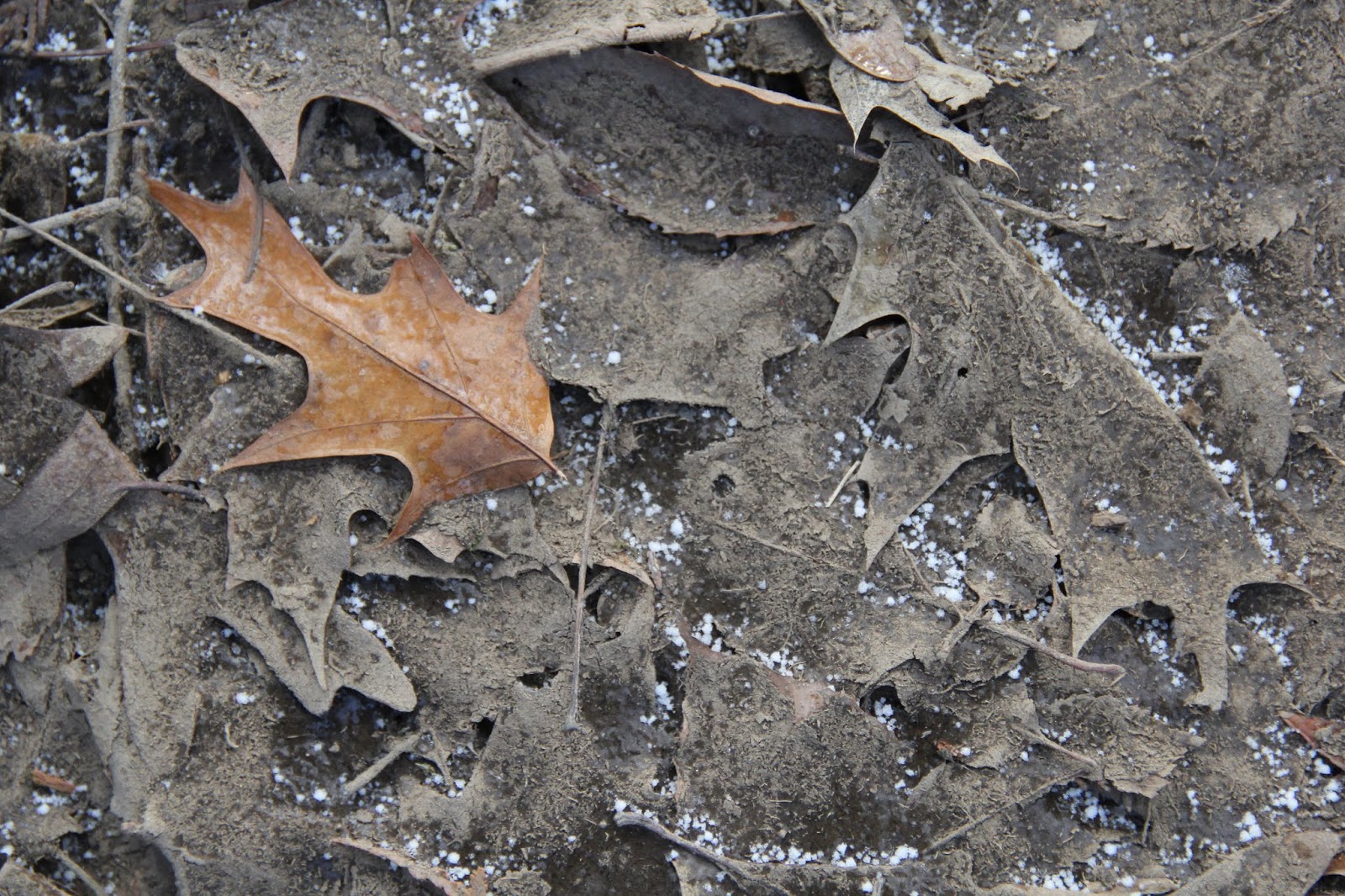
Silt covered leaves, topped by a single clean oak leaf

A boardwalk crosses an eroded area on the trail

Northern White Cedar

The bright trunks of aspen trees glow in the sunlight

Wednesday, May 2, 2018

Wildflower Walks - One Completed (29 April 2018) and One Upcoming (06 May 2018)

On Sunday (29 April 2018) I led a wildflower identification walk for a small group from the Michigan Alliance for Environmental and Outdoor Education (MAEOE) at Sleepy Hollow State Park.  The bloom for most species has been delayed by the cold spring, but we were still able to find and identify around ten different species.


Bloodroot


Mayapple

Yellow Trout Lily

The highlight of the day (at least for me) was finding a pile of bear scat.  Why is this exciting?  It's exciting to me because Sleepy Hollow State Park is outside the main range of Black Bear in Michigan.  I already knew that bear lived in the area - my parents live a few miles away and have seen a bear on their property.

A pile of bear scat

Did you miss this hike?  There is another wildflower hike scheduled for this Sunday (06 May 2018) at the Chippewa Watershed Conservancy's Williams-Blackburn Preserve.  The walk is scheduled for 1:00PM to 3:00PM.  For directions click on the previous link.  The warm weather and rain should really rev up the wildflower bloom.

Thursday, August 17, 2017

Nature Geek Vacation Destinations - Custer State Park, Custer, SD

One of the highlights of our recent vacation in South Dakota was a pair of visits to Custer State Park.  Our first visit to Custer State Park was preceded by a trip to Mt. Rushmore National Monument.  From Mt. Rushmore, the shortest route into Custer State Park is US Route 16A.  Also known as Iron Mountain Road, this route passes through three tunnels and multiple switchbacks and loops that frame views of Mt. Rushmore.  There are also several scenic turnouts and parking areas that allow you to see panoramic views of the Black Hills and the plains to the east of the park.


At the eastern edge of the park Route 16A joins up with South Dakota Highway 36.  SD 36 will lead you east out of the park.  If you continue west on 16A, you will need to purchase a South Dakota State Park entrance permit.  As of July 2017, annual permits cost $30; Custer State Park also offers the option of a 7-day pass for $20.  We chose to purchase the 7-day pass as we did not intend to visit any other South Dakota State Park.  A short drive from the entrance gate is the east end of the park's Wildlife Loop Road.

Tuesday, January 26, 2016

Hall's Lake Hike Highlights (23 January 2016)

On Saturday (23 Jan), I led a walk for the Chippewa Watershed Conservancy (CWC) at their Neely and Kabana Preserves in western Isabella County.  The Neely Preserve is part of a larger parcel known as the Hall's Lake Natural Area.

http://i2.wp.com/www.chippewawatershedconservancy.org/wp-content/uploads/2014/08/NeelyPreserveLarge.gif 
Our walk focused on animal sign.  When most people think of animal sign they think about tracks, but tracks are only a small part of the picture.  We looked at tracks, but we also searched for other things such as animal homes, signs of feeding, food caches, and scat. 

Looking for animal sign at Hall's Lake Natural Area

I have been to the Hall's Lake Natural Area several times in the past, but never to areas that we visited on Saturday.  Because I had never visited these sites, I had not expectations about what to expect.  Much of the two preserves are covered by a mature mixed conifer-hardwood forest.  Several inches of snow covered the ground, including a dusting about 36-48 hours prior to our walk.

I was actually surprised, by the lack of sign from several species.  There were very few tracks from White-tailed Deer, no deer scat, and no evidence of recent feeding.  Rabbit tracks were only found in the the area immediately adjacent to the lake in any area of swamp.  We also did not see or hear a single bird during our almost two hour walk.  In fact, I didn't see a single live animal of any species while I was there.

So what did we find?

There was lots of evidence to indicate that squirrels live in the preserve.  We saw squirrel tracks heading from tree to tree in most of the preserve.  There were also places where the squirrels had dug through the snow to search for cached (hidden) acorns.  Most squirrels do a really poor job of remembering where they have cached acorns and other nuts.  Instead they rely on their sense of smell to locate food hidden under the snow.  This means that they do not recover all of the things that they have buried.  Many of those nuts (and other seeds) will germinate during the following year.  So even though the squirrel may not benefit from everything that they have hidden, they are helping to reseed the forest.

Unfortunately, squirrel tracks are not all that exciting.  Neither were the hundred of mouse tracks that we saw throughout the forest.  While these tracks are interesting and give an insight into the small prey species found throughout the forest, they are not something that gets my heart pumping.

This, however, does.


That is a pile of coyote scat.  It was full of hair and seeds, indicating that the coyote that left this in the middle of the trail was eating a diverse omnivorous diet.

Why was the pile of scat in the middle of the trail?  Like all canines, coyotes frequently mark their territory.  There was evidence that someone had recently walked down that trail with a domestic dog.  The coyote left that scat in the trail to cover over the dog's scent and assert its dominance.

Scat was not the only coyote sign that we found.  We found several sets of tracks including this set on the ice covering the outlet to the lake.


Coyote tracks on the ice

The coyote skirted around several area of thin ice

Following tracks onto the ice - make sure the ice is solid before proceeding

For me the other highlight of the walk was a visit to an active porcupine den tree.  CWC Executive Director Stan Lilley led the group to this site.  Unfortunately, the porcupine crawled up inside its den as the group approached so we did not get to see it, but it left lots of evidence of its presence.  (This is not the not the first den tree that I have seen on a CWC property - in 2015, I found one at the Quigley Creek Natural Area.)

Examining porcupine scat under the den tree

The porcupine left a prominent trail from its den to its feeding area in some nearby pines

The porcupine den is in the hole in the left trunk

A pile of scat under the den tree

Even though I did not see a porcupine, it is always worth the time to take a walk in the woods.  It was especially enjoyable to share my knowledge of animal tracks and sign with other nature lovers.  One participant commented that it was going to make her walk to the end of the driveway to get the daily newspaper a lot more interesting.

For more photos from the walk please check out the Chippewa Watershed Conservancy's website.

Monday, June 1, 2015

Quigley Creek Porcupines

Last year during a plant survey at the Quigley Creek Natural Area I found the remains of a dead North American Porcupine (Erethizon dorsatum).

North American Porcupine skeleton

A couple of weeks ago (20 MAY 2015), during a return trip to Quigley Creek, we found a porcupine den tree.  This hollow tree has probably been occupied by a porcupine for months.  The ground beneath the tree was covered by a thick layer of scat.

Porcupine den tree