Showing posts with label erosion. Show all posts

Wednesday, July 12, 2017

Nature Geek Vacation Destination - Devil's Tower National Monument (Crook County, WY)

On Monday I wrote about how a visit to Badlands National Park left me completely awestruck.  There was one other location that we visited during our vacation that had the same effect on me - Devil's Tower National Monument.

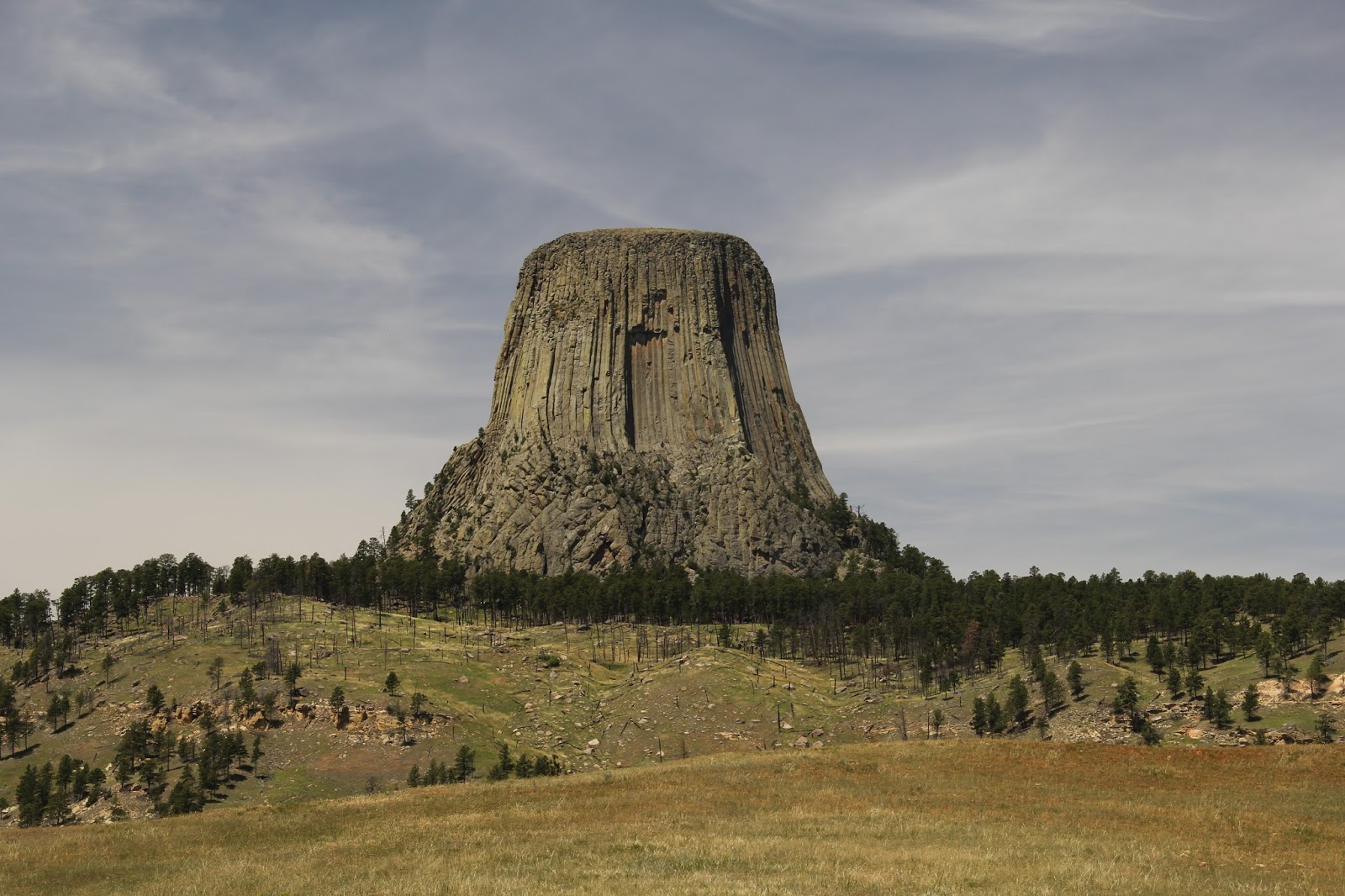
Devil's Tower as seen from the road entering the Monument
Devils Tower a monolithic rock structure composed primarily of an igneous rock known as phonolite porphyry.  Like granite, phonolite forms when magma below the surface of the earth cools slowly allowing visible crystals to form.  Phonolite contains many of the same minerals as granite, but largely lacks quartz (a prime component of granite).  Instead, the bulk of phonolite is composed of potassium feldspars.  The phonolite at Devil's Tower is a type known as phonolite porphyry.  To say that a rock is porphyritic means that it has both small and large crystals.  At Devil's Tower, the phonolite porphyry cooled at a rate that caused it to contract and form vertical columns of hexagon rock up to 15 feet across.  These columns give the surface of Devil's Tower its unique look.

Devil's Tower - note columns of igneous rock and boulders littering its base

There are several theories of how Devil's Tower formed.  The simplest theory is that a column of magma pushed up from the earth's mantle through overlying layers of sedimentary rock.  This magma probably cooled and solidified before it broke the surface - there is no evidence to suggest it reached the surface.  Over time the layers of sedimentary rock eroded away, exposing the harder igneous rock that forms Devil's Tower.  The tower itself is slowly eroding away as evidenced by the broken boulders of phonolite porphyry scattered around its base. 

Devil's Tower rises 867 feet (265 meters) from its base to its summit.  Completely isolated from any other peaks, it rises above the surrounding prairie and pine forests.  Awesome (in the sense of causing or inspiring awe; inspiring an overwhelming feeling of reverence, admiration or fear) barely begins to describe Devil's Tower.  It is little wonder that all Native American Tribes from the region consider it a sacred place.  Many of the trees at the base of  the tower are tied with prayer bundles.

Devil's Tower - note the prayer bundles tied to the tree at the right of the image

Because of the site's sacred nature and its unique geology, in 1906 President Theodore Roosevelt used the newly passed Antiquities Act to declare Devil's Tower our nation's first national monument.  Administered by the National Park Service, Devil's Tower National Monument protects the tower and approximately 1374 acres (a little over two square miles) of surrounding prairie and Ponderosa Pine forest.

If you want to visit Devil's Tower, from Mid-Michigan it is approximately one thousand two hundred eighty mile (or nearly nineteen hours) of driving away.  Obviously, this is not a weekend trip, but when combined with other sites such as the Badlands and Black Hills this is a can't miss vacation destination for any nature geek!

If you do choose to travel to Devil's Tower, here's a little hint:  the best views of the tower are not the one's you get by visiting the base of the tower.  The base of the tower is crowded, with approximately 400,000 visitors each year.  Do yourself a favor and after leaving the visitor center parking lot, turn onto a gravel road that lead to the Joyner Ridge Trail.  This road lead to a gravel parking lot about one mile northwest of Devil's Tower.  When we arrived there, there were only two other cars in the lot.  Here is the view you are rewarded with...


Here are a few more Devil's Tower photos from the Joyner Ridge trailhead.  I like how the clouds in these images look like a puff of smoke coming out of the Tower.  Enjoy.


This final picture is probably my favorite on of Devil's Tower with the lone Ponderosa Pine, grasses, and the Tower off in the distance surrounded by more pines.


Monday, July 10, 2017

Nature Geek Vacation Destination - Badlands National Park (Interior, SD)

awesome
adj.
Causing or inspiring awe; inspiring an overwhelming feeling of reverence, admiration or fear

awful (archaic)
adj.
inspiring reverential wonder or fear

awestruck
adj.
filled with or revealing awe


The word awesome is overused.  People use it when they mean something is good.  For instance, someone might say their strawberry-banana-kale-chia smoothie is "Awesome!"  Or a waiter at a restaurant my respond to my order of nachos with "Awesome!"

I just returned from a two week vacation.  Shara and I drove three thousand eight hundred miles and visited nine states.  In that time I saw two places that I could literally describe as awesome in the sense that they inspired an overwhelming feeling of reverence, admiration, or fear.  The first of these places was the Badlands of South Dakota.  The Badlands are a place of truly awful (inspiring reverential wonder or fear) beauty.  Shara commented while were standing on an overlook that she felt very insignificant - that is a very good thing to say about the Badlands. I have no words to describe them - I was literally awestruck by their grandeur.

The Badlands were formed by two geologic processes, deposition and erosion.  Over the course of tens of millions of years layers of sediment (sand, mud, volcanic ash, etc.) were deposited in the area that is today known as the Badlands.  For the past approximately 500,000 years wind and water have been eroding those sediments, creating the gullies, hills, and outcrops that we see today.  Geologists predict that in another 500,000 years the Badlands will be completely eroded away.  For more information on the Geology of Badlands Nation Park please visit this National Park Service webpage

Although photographs cannot do the Badland justice, here are a few of hundreds of pictures that I took during our visit.  If you want to visit the Badlands, they are almost due west of Mid-Michigan approximately one thousand one hundred miles (or sixteen hours) of driving away.  From the Badlands it is only another ninety minutes of driving to the Black Hills area (more on this later).

For now, here are my Badlands photos.  Enjoy.

Wednesday, April 16, 2014

Chippewa River Floods - 2014 edition

One year ago Mid-Michigan experienced its most severe flooding in nearly thirty years.  With heavy rains over the weekend, many rivers in our area are again experiencing flooding this April.  The flood waters are not as high, but are still impressive.  Here are some photos that I took over the past two days.

The first few photos were taken on Monday at Chipp-A-Waters Park in Mt. Pleasant.

Probably not the brightest idea...  Parks workers taking a Gator through 8 or more inches of water.

The Chippewa River is to the left in this photo.  The tree in the foreground in normally several feet above water on the near bank.


The canoe landing at Chipp-A-Waters Park - the end of the landing is several feet under water at this stage

Eroding riverbank at Chipp-A-Waters Park - there is a planned project to stabilize this bank over the Summer.

The next six photographs are also from Monday.  This set of pictures was taken at Mill Pond Park - downstream from Chipp-A-Waters Park.

Pedestrian bridge over the Chippewa River - If you click the link in the first paragraph you can see a photo from the same vantage point taken one year ago.

Water flowing over the weirs in Mill Pond Park

A large tree trunk stuck on a weir - the trough in the water in front of it was probably more than 2 feet deep.  A half hour after this picture was taken this tree trunk was gone, washed downstream by the strong current.

Water rushing against the dam in Mill Pond Park

It's called a "floodplain" for a reason...

Waterfowl were enjoying the flooded shorelines;  pedestrians, not so much...

The next photograph was taken on Monday at Nelson Park, the next park downstream. This was my favorite photo of the day.  Water levels continued to rise after this picture was taken. 

An American Crow (Corvus brachyrhynchos) forages along the edge of the flooded lawn at Nelson Park
The remaining photographs were taken on Tuesday at Island Park and Pickens Field.  These parks are downstream from all the parks in the above photos.

Flooded softball field at Pickens Field

Looking across the pedestrian bridge from Pickens Field to Island Park - the Vietnam Memorial is mostly underwater

Flooding at Island Park in Mt. Pleasant - Maybe that sign should have a swimmer on it instead...

Flooding from the Chippewa River at Island Park - the line of small trees in the center for the photo shows the normal location of the riverbank.