Showing posts with label field trips. Show all posts

Thursday, July 5, 2018

Field Trip - Maple River State Game Area

Yesterday (04 July 2018) I took a short trip to the Maple River State Game Area (MRSGA).  I have lived in Mid-Michigan for the majority of my life, but I have never visited MRSGA before despite driving through part of it hundreds of times.  I grew up in the area and hunted and fished in several State Game/Wildlife Areas as a youth, but because MRSGA has been managed primarily for waterfowl and I have never been a duck or goose hunter so this area was mostly not on my radar.

With no other plans for the morning I decided it was finally time to explore the area a little.  My trip took me to a part of the game area known as the East Unit (Wetlands Wildlife Management Unit).  This Unit is located on both sides of US-127 between St. Johns and Ithaca.  The East Unit is further (confusingly) subdivided into smaller sections also known as units.  The highway itself separates Unit A on the west side of the road from Unit B on the east side of the road.  Several other Units stretch further east from Unit B including a Wildlife Refuge that is closed to the public from September 1st to December 1st. 


There is a parking lot located along US-127 at the northwest corner of Unit B.  This is where I began my visit.  Unit B like most of these other units is enclosed by a series of dikes that allow the water level to be raised or lowered on a seasonal basis.  I walked east along the dike on the north edge of the unit to the dike that separates Unit B from the Wildlife Refuge and followed that dike south.  I returned to my truck by the same route.

The berm along the north edge of Unit B

Along the east edge of the unit is a wood observation tower.  This tower is actually visible from the highway.  The tower was my goal of my hike.  For some reason I didn't take any photos of the tower, but I did take several of the view from the top.  There is also a handicap-accessible ground blind along the North boundary of Unit B.  The view right now consists entirely of tall cattails; I did not take any photos from there.

The view South from the observation tower - berms and a ditch can be seen on the left of the image

Southeast - a better view of the ditches and berms that mark the edges of the Units

West-northwest - the highway is the white line on the horizon

East - looking across the Wildlife Refuge

It didn't seem like it at the time, but I was able to see and photograph a surprising amount of wildlife.  This included butterflies such as Monarchs (Danaus plexippus) and Eastern Tailed Blue (Cupido comyntas).  I also saw several species of Skippers, a Fritillary, and a bunch of small brown butterflies with eyespots on their wings including Wood Nymphs (Cercyonis pegala).

Monarch

Eastern Tailed Blue

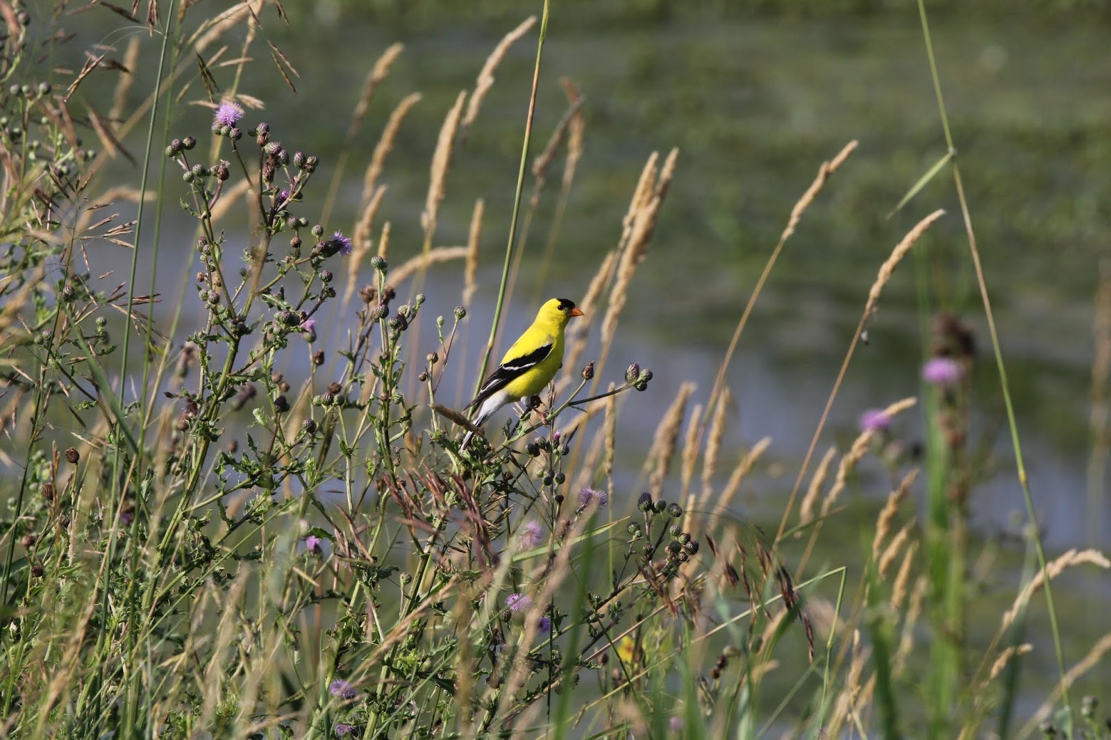
I also saw lots of birds.  A partial list includes Red-winged Blackbird (Agelaius phoeniceus) , Song Sparrow (Melospiza melodia), American Goldfinch (Spinus tristis), Mallard (Anas platyrhynchos), Wood Duck (Aix sponsa), Great Blue Heron (Ardia Herodias) , Green Heron (Butorides virescens), Double-crested Cormorant (Phalacrocorax auritus), Barn Swallow (Hirundo rustica), Cedar Waxwing (Bombycilla cedrorum), Bald Eagle (Haliaeetus leucocephalus), and Osprey (Pandion haliaetus).


Red-winged Blackbirds in a drowned tree
 
Red-winged Blackbird on cattail
 
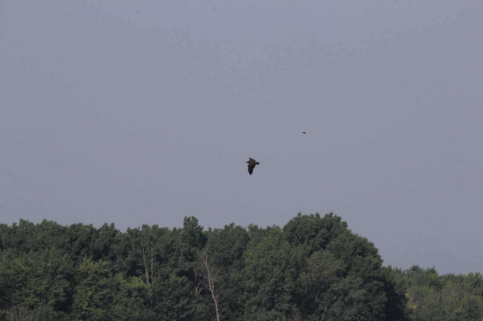
Juvenile Bald Eagle being chased by Red-winged Blackbird

Cedar Waxwing

American Goldfinch

Green Heron

A young Wood Duck runs across the water to hide in some cattails
In one of the ditches I noticed a schools of smallish (6-8 inch) Large-mouthed Bass and Bluegill sunfish.


I also saw several White-tailed Deer (Odocoileus virginianus) including this buck. 


I also had a fawn run up to me and approach within ten feet.  I'm not sure why it came up to me, except maybe curiosity.  It saw me well before it approached.  I shooed it away when it got too close, but I was able to get several good photos before it ran into the woods.


I plan to go back to Maple River State Game Area, but probably not until next spring.  I want to see if I can photograph some of the thousands of migratory waterfowl that pass through every year.


Wednesday, September 27, 2017

Field Trip - Boardman River Fish Weir, Traverse City, MI


Coho and Chinook Salmon are not native to the Great Lakes.  They were introduced into the Great Lakes in the 1960s by the Michigan Department of Natural Resources (DNR) in an attempt to solve two problems.

The native population of Lake Trout was nearly extinct due to a combination of overfishing and predation by non-native Sea Lampreys.  Also, populations of a non-native fish the alewife exploded in the Great Lakes.  Alewives frequently experienced seasonal die-offs as they exhausted food supplies.  Their bodies would then wash up on Great Lakes beaches making them inhospitable.  Both Sea Lampreys and Alewives were introduced to the Great Lakes when the Welland Ship Canal.

By introducing Salmon, the DNR hoped to revive the Great Lakes sport fishery and reduce Alewife populations to an acceptable level.   The introduction was a wild success.  Today, Salmon remain a popular sport fish in the Great Lakes.

Great Lakes Coho and Chinook Salmon sped most of their lives swimming in the open waters of the lakes.  At the age of three, they return to rivers to spawn. After these salmon spawn they die just like all Pacific Salmon species; Atlantic Salmon live after after spawning and return to the ocean.

When salmon were first introduced in the Great Lakes this caused a huge problem in Traverse City.  Four dams spanned the river preventing salmon from migrating far upstream (one of these dams has been removed and two others are slated for removal).  This meant that when the salmon spawned and consequently died they did so within the city limits of Traverse City.  Saying that the resulting smell was unwelcome is an understatement!

The solution was to build a harvest facility to collect salmon from the river before they could spawn and die.  This facility, known as the Boardman River Weir, consists of a weir that blocks passage upriver, a fish ladder that leads to a series of survival tanks, and a building that contains sorting tables and other equipment for processing the fish.


The weir allows water downstream, but blocks fish from traveling upstream
The fish ladder is staggered to allow salmon to rest before swimming up each spillway.

The holding tanks and fish ladder a fenced off to prevent people from taking salmon.

Inside the building, processing tables are used to sort salmon for shipping to distributors.  Tubes lead to a recovery tank so trout, steelhead, and Atlantic Salmon collected in the weir can be returned to the river.

Carbon Dioxide and Oxygen are used as an anesthetic to calm the fish so they can be handled for processing.  The basket on the right is used to lift the anesthetized fish up onto the sorting tables.

The number of salmon (and other species) collected are recorded and posted so the public can see what is happening.  Windows look in on the processing facility

During the fall salmon run, staff from the Michigan DNR is on site to answer questions and give tours of the facility.  We are lucky enough to know several of the DNR employees at the weir and we were allowed to stay inside the fence taking photos as long as we wanted.


Once in the holding pens salmon just cruise around as there is nowhere further upstream for them to go.  Occasionally one will jump up out of the water, sometimes even landing on the concrete walkway.
The weir spans the entire river, blocking passage upstream upstream, but allowing water through

Despite the barrier, a small number of salmon jump over the weir and continue upstream.


Debris has to be removed from the weir periodically so water can flow through.  If the water flows over the weir salmon will be tempted to jump over instead of entering the fish ladder.

The view of the facility from the weir.

While we were watching several fish attempted to make their way up the fish ladder.  Some of the fish had an easy time; others struggled to make it upstream.  The staggered spillways ensure that there is an area of slack water at each level, allowing tired fish to rest before ascending to the next level.

This salmon just swam up the ladder

This salmon jumped up the spillway to the next level.

The bright sunlight made it easy to see the salmon as they swam around the holding pens.

Unfortunately not every salmon that makes it up the fish ladder survives until harvest.  Some salmon are simply too exhausted and beat up by their journey.  When that happens the dead fish are removed from the pen and disposed of.

DNR employee Francis Majszak gaffs a dead salmon and removes it  from the holding pen at the Boardman River Weir.

This dead salmon had a surprise.  That's a juvenile Sea Lamprey attached to its tail fin.

A closer view of the juvenile lamprey.  Because the Sea Lamprey is an invasive species it was destroyed rather than being returned to the river.

If you would like to learn more about the Boardman River Weir, the brochure shown below can be downloaded from the Michigan DNR.  The fish weir typically remains in operation through October.  It's only a 2 hour drive from Mid-Michigan and is a great place to visit while in the Traverse City area, especially when combined with a fall color tour of the Old Mission Peninsula, Leelanau Peninsula, or Sleeping Bear Dunes National Lakeshore.


Tuesday, August 22, 2017

Field Trip to Peterson Natural Area (12 August 2017)

Field trip participants (Cathy Murray, Dick and Diana Moreau, and Ruth Chapman) pose by the preserve sign
 
On Saturday August 12th, I led a field trip to the Chippewa Watershed Conservancy's Peterson Natural Area.  At 79 acres, Peterson NA is one of the largest preserves in the CWC's inventory.  It is also (probably) one of the least visited.  Located in Mecosta County, Peterson NA is much closer to Big Rapids (less than 10 miles) than it is to Mt. Pleasant (approximately 40 miles).  This distance from Mt. Pleasant puts off the radar for most CWC supporters - if you are going to Peterson Natural Area you are making a time commitment.

Despite the distance from Mt. Pleasant (or in my case from Alma), visiting Peterson Natural Area is worth the effort.  Here are a few pics from that visit.

Ruth was wearing a walking cast and needed a helping hand to navigate a couple stretches

Goldenrod Soldier Beetle (Chauliognathus pensylvanicus) on Great Blue Lobelia (Lobelia siphilitica)

The surprise of the day was finding a Wood Turtle (Glyptemys insculpta) in the wet meadow that runs down the center of the property.  The Wood Turtle is considered a Species of Special Concern by the State of Michigan so it is always a thrill to see one.  Wood Turtles do frequently spend much of the summer in upland areas, but I didn't suspect that the small stream running through Peterson Natural Area would bring one to the property from the nearby Muskegon River.  I actually found this turtle with my feet - while walking through the tall grass of the meadow, I stepped on what initially I thought was a rounded rock.  Surprise!


Cathy photographing the Wood Turtle

Who wouldn't love that face!

Joe-pye Weed (Eutrochium maculatum) was growing everywhere along the stream.

Swamp Milkweed (Asclepias incarnata) adds its magenta hues to the landscape mosaic.

Mating Yellow-collared Scape Moths (Cisseps fulvicollis) on Common Boneset (Eupatorium perfoliatum)

Giant Swallowtail (Papilio cresphontes) nectaring on Swamp Milkweed
The upland parts of the property (northwest quarter) is very different from the low area along the stream.  It is very dry and sandy.  The Michigan Natural Features Inventory pre-settlement vegetation map indicates that Peterson Natural Area was once covered with Beech-Sugar Maple-Hemlock Forest, but the vegetation on this hill is currently more like that found on a Dry Sand Prairie or Oak-Pine Barren.  Pre-settlement maps indicate that two areas of  Oak-Pine Barren could be found within two miles of Peterson NA in the past.


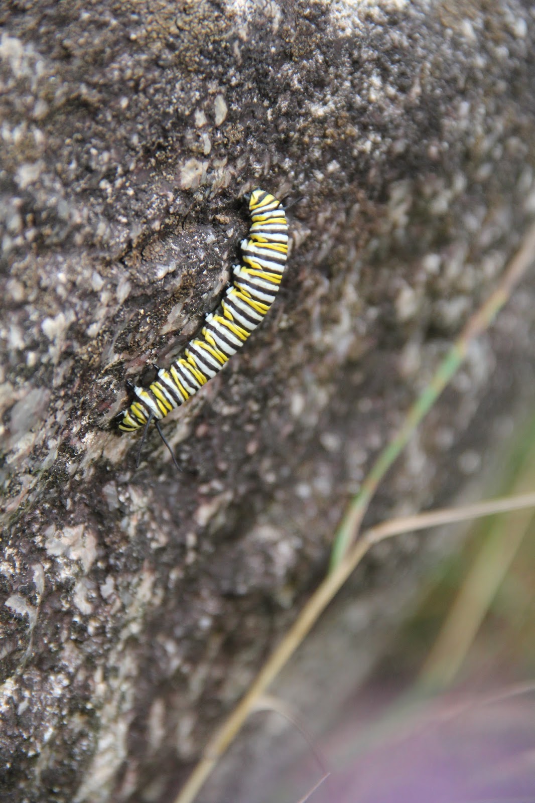
Near the end of our walk, we found three Monarch caterpillars.  All three were in their 5th instar and were almost ready to enter the chrysalis stage.  The first two caterpillars were feeding on Common Milkweed plants.


Ruth zooms in on a Monarch caterpillar


The third caterpillar was crawling around on the side of a large rock.  In the hours before forming a chrysalis, Monarch caterpillars (and those of other butterfly species) often wander far from their host plant.


If you are interested in visiting Peterson Natural Area, this is the best time of year to do so.  The late summer wildflowers in the wet meadow are at their peak and the fall asters and goldenrods will be blooming soon.  If time allows, I may try to take one more trip over before the bloom is done.